In the middle of Romania between cities of Sibiu and Brașov, wall of mountains rises from the Transylvanian plateau. And what a wall it is! After slovakian High Tatras, Făgăraș is the highest part of Carpathians with Moldoveanu peak reaching 2544 meter above sea level. With the main ridge 70 km long and hardly falling below 2000 meters of height Făgăraș is also very intimidating mountain landscape.

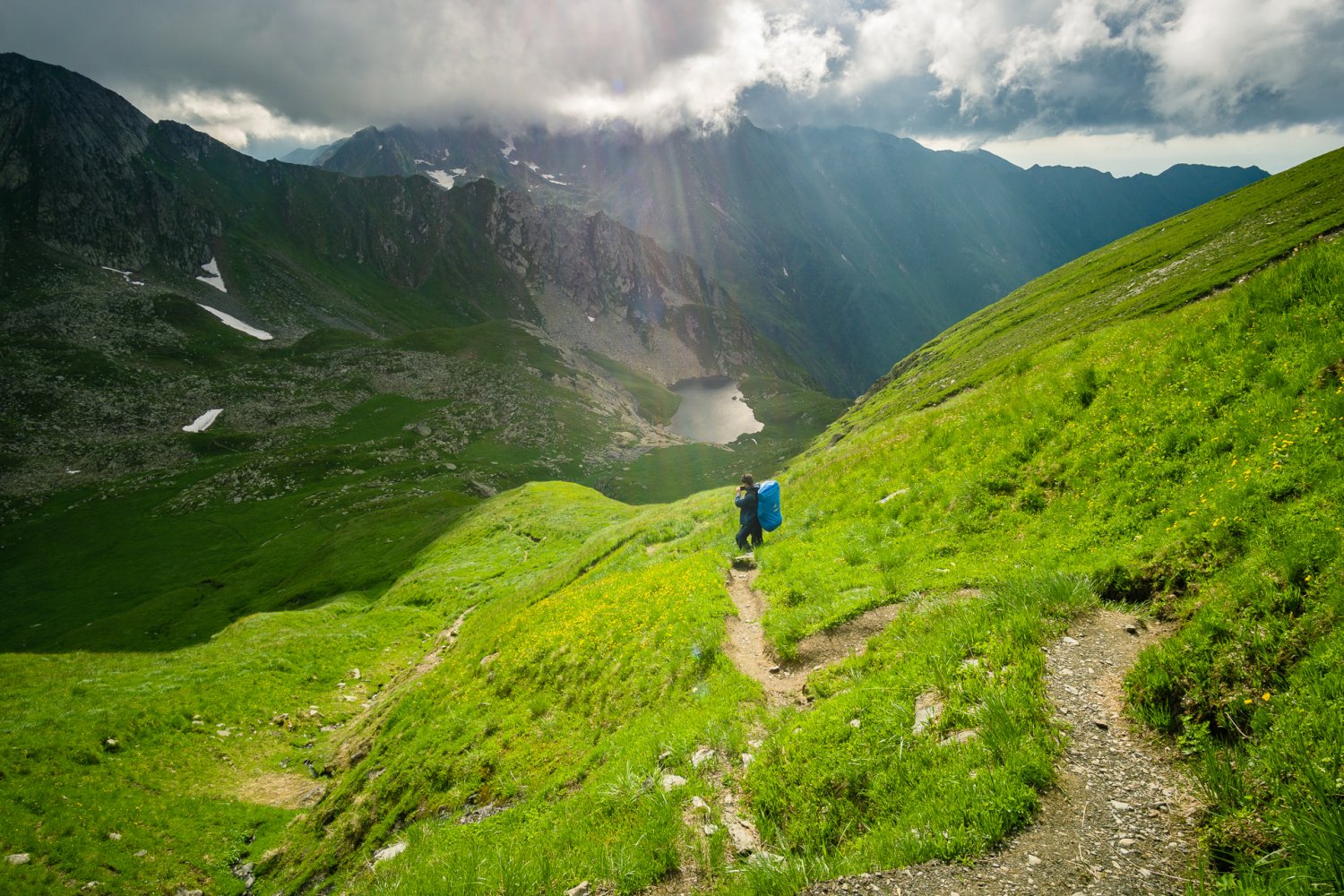
Capra Lac during ascent to Vânătoarea lui Buteanu

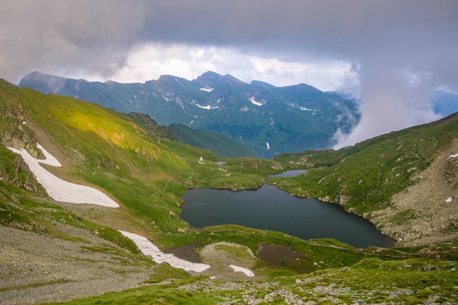
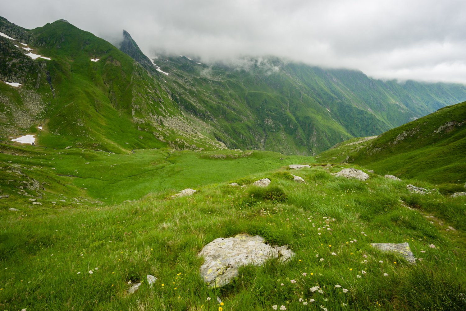
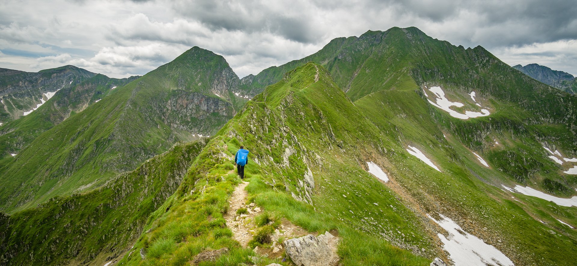
Upper end of Arpășel valley
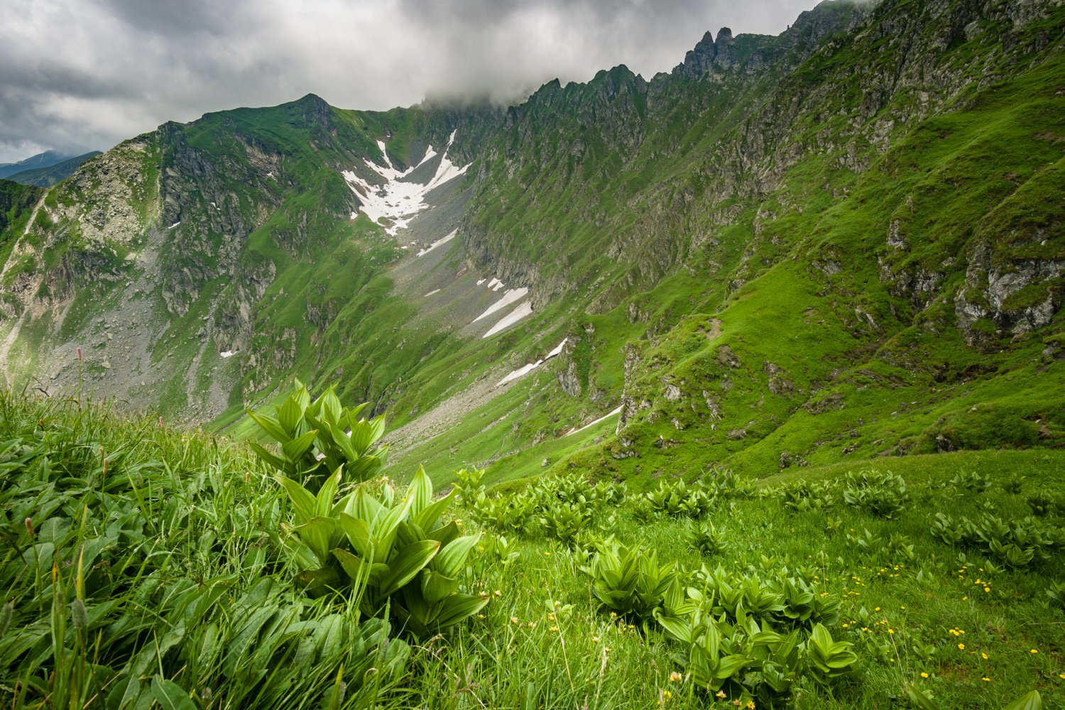
Făgăraș or Munții Făgărașului translates as "Windy mountains" and that does not come out of nowhere. Very strong wind is a common companion both on the main ridge and on open plateaus around glacial lakes. Moreover the mountains are somewhat famous for very strong thunderstorms that to this day cost many lives and the main ridge is full of memorial crosses. The reason for this is that many passages on the main ridge simply do not allow to find safe shelter and once caught in the storm, the risk of getting hit by lightning increases. Wild bears still roam lower forested parts of the mountains and mainly long, desolated and hardly accessible valleys on the southern side of the mountains. Meadows just above tree level are often used by shephards with large sheep herds and sharp shepherd dogs.
Between Capra Lac and Fereastra Zmeilor

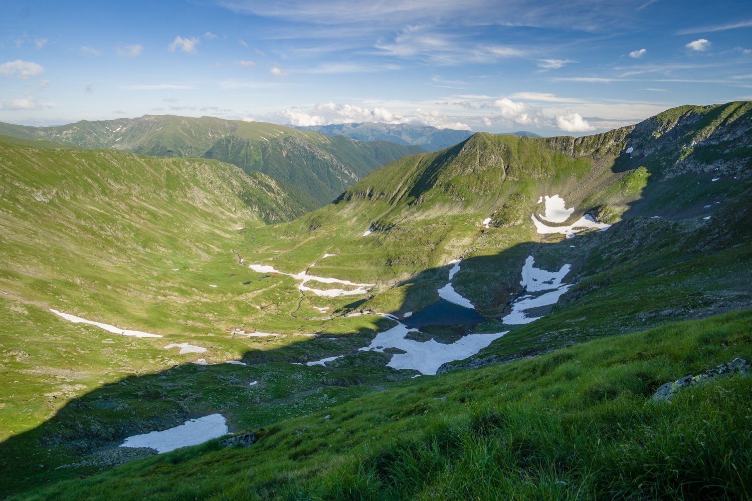
Enroute to Strunga Podrăgelului


Afternoon at Şaua dintre Lacuri

Căldarea Văii Rele during descent from Viștea Mare
Apart from other high ranges in Romania like Retezat or Rodna, Făgăraș is not protected in a national park (at least not yet, as preparations are probably being taken right now in 2019). That may seem like the area is not that interesting but the truth may be more simple: Făgăraș is so huge and most of it so hardly accessible that there was no immediate need to establish official protection. It also means that as a hiker you are almost completely free to camp anywhere and limited only by the terrain. Which, to be honest, means you are practically limited to small flat spots around lakes or around emergency refuges. Hardly anywhere else around the main ridge there are flat spots large enough to set up a tent.
The trail
The main ridge trail itself is also interesting. With finger on the map it looks like easy walk from lake to lake but the reality is it goes up and down, up and down and up and down again. Many passages (marked in the map with "!") are also secured with chains or metal ropes and exposed with rock or steep slopes falling to both sides of the path. The highest mountain Moldoveanu is also accessible through a rocky saddle secured with chains, but a short one. Usually the second highest mountain of Negoiu and ascent route over Șerbota summit is reffered as the most technically difficult ascent in Făgăraș. Three rocky columns that you have to cross on the main ridge between Bâlea Lac and Moldoveanu got a poetic name La trei pași de moarte which literally translates as "Three steps from death".

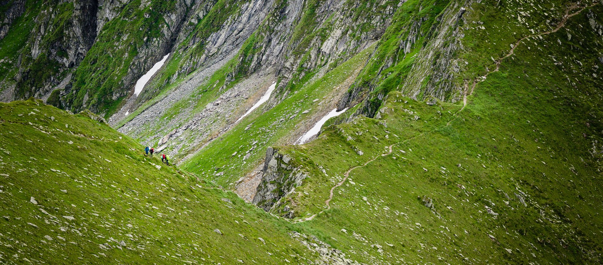
Hikers on the ridge trail
"Normal" parts of the trail are not less interesting though. From my personal experience the path seems to go through almost impossible places when seen from the distance. However, getting closer reveals that reality is far less horrifying. Still, with a heavy backpack on your back, these places often require caution. Two Romanian hikers I met along the trail confirmed that often these parts are worse to cross. Quoting one of them: "Where there are chains, it is OK. I do not suffer fear of heights but descent from Mircii is the only place I do not feel completely safe in Făgăraș. With all that open space before you and slippery rocks I am always relieved when I cross it."

Trail between Arpașul Mare and Arpașul Mic
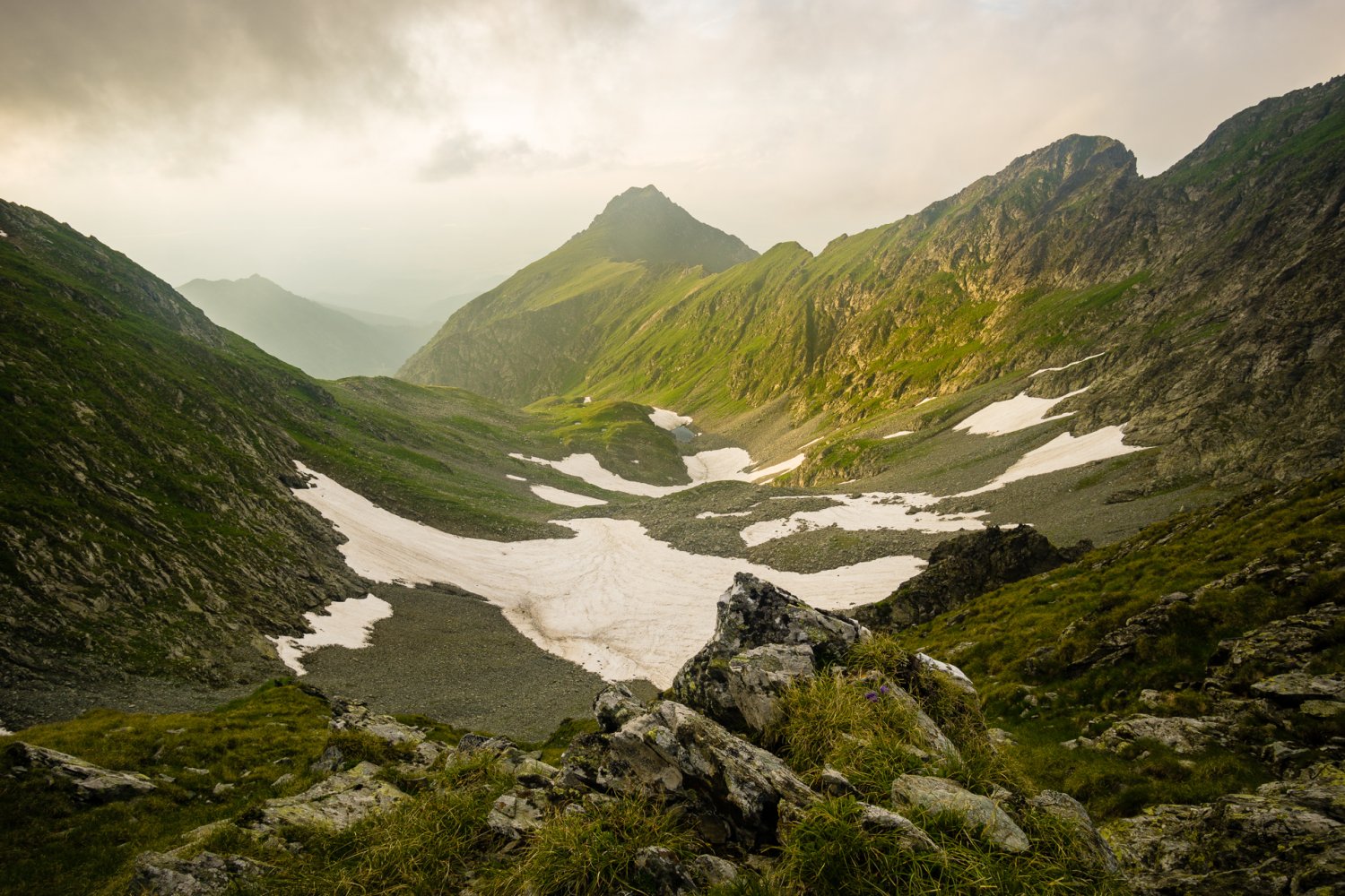
Another thing is snow that can completely change easy path into white hell. Most of the deaths in Făgăraș come as a result of avalanche or sliding off the slippery ridge. In early summer a lot of snow may still remain on the paths, forming steep slippery roofalike slopes. After rainfall (which comes normally at least at night) footprints in the snow may be completely lost and if fog comes in the orientation becomes quite complicated.
Visual profile and photography
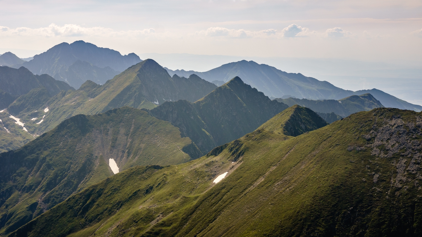
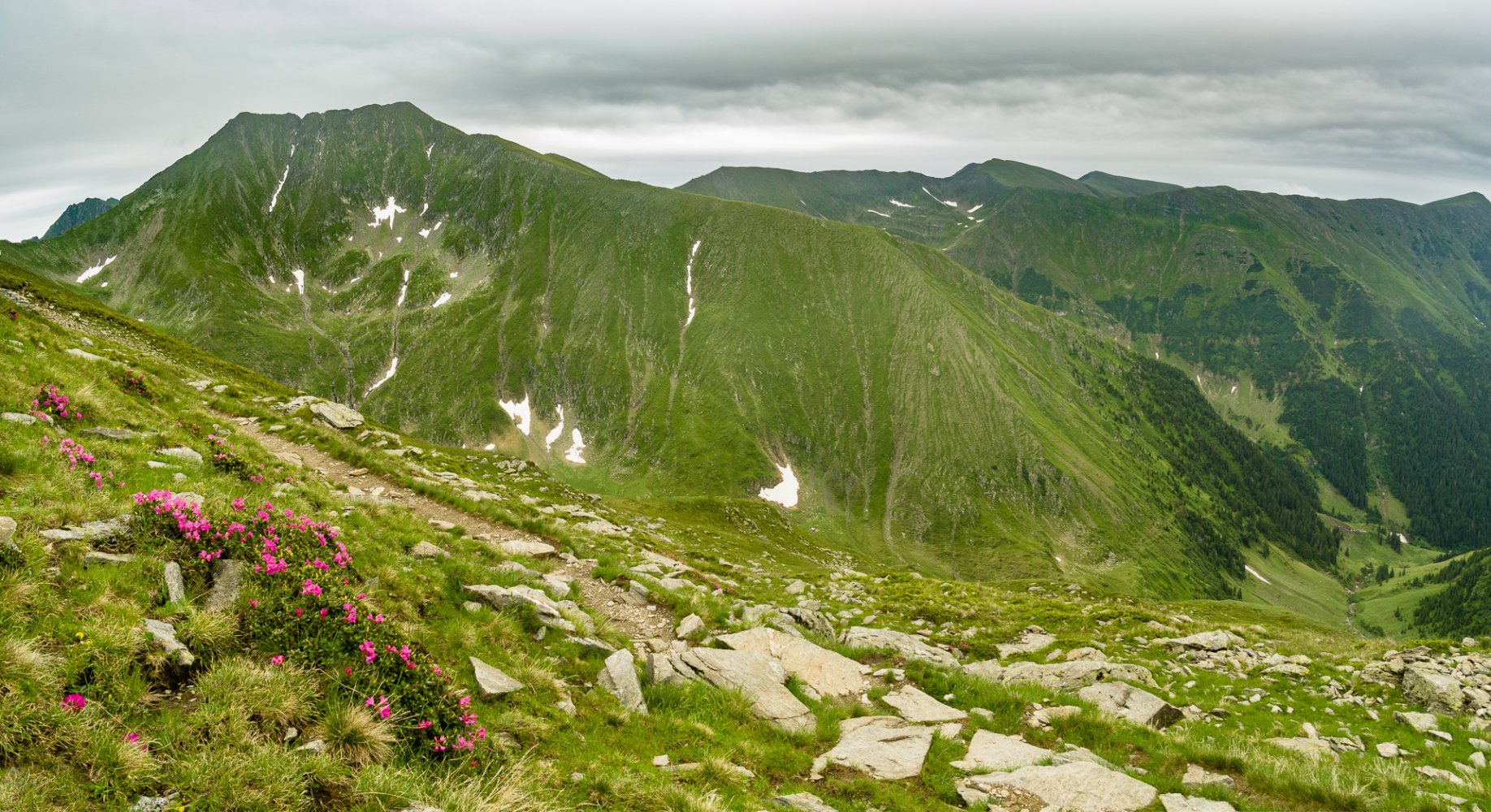
What to expect from photographic point of view in Făgăraș? Făgăraș is quite different to other mountain ranges of its height both in Romania and elsewhere. Compared to High Tatras in Slovakia which are just slightly higher, Făgăraș seems "easier" and less rocky at first. It is probably because Făgăraș is in its upper level mostly covered with grass. Even the whole Moldoveanu looks like a green roof as grass grows all the way up to the summit.

Double summit of Viștea Mare and Moldoveanu looks like a roof
Immediate interesting places are of course many glacial lakes that formed in side valleys along the main ridge. There are usually nice accesible spots above them to capture it as part of the whole landscape. It is also common practice to camp by these lakes in the evening as mentioned before so it looks promising in terms of sunsets and sunrises. The truth is that almost always these lakes are surrounded by south - north oriented side ridges and dwell in shadow long before sunset and long after sunrise.
Main ridge from Moldoveanu

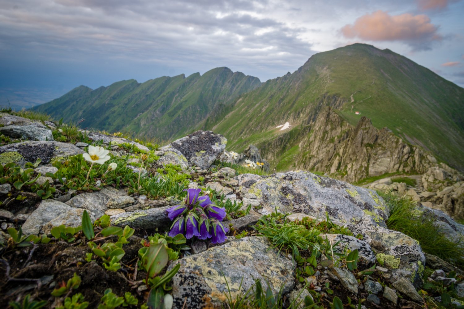
Carpathian bellflower
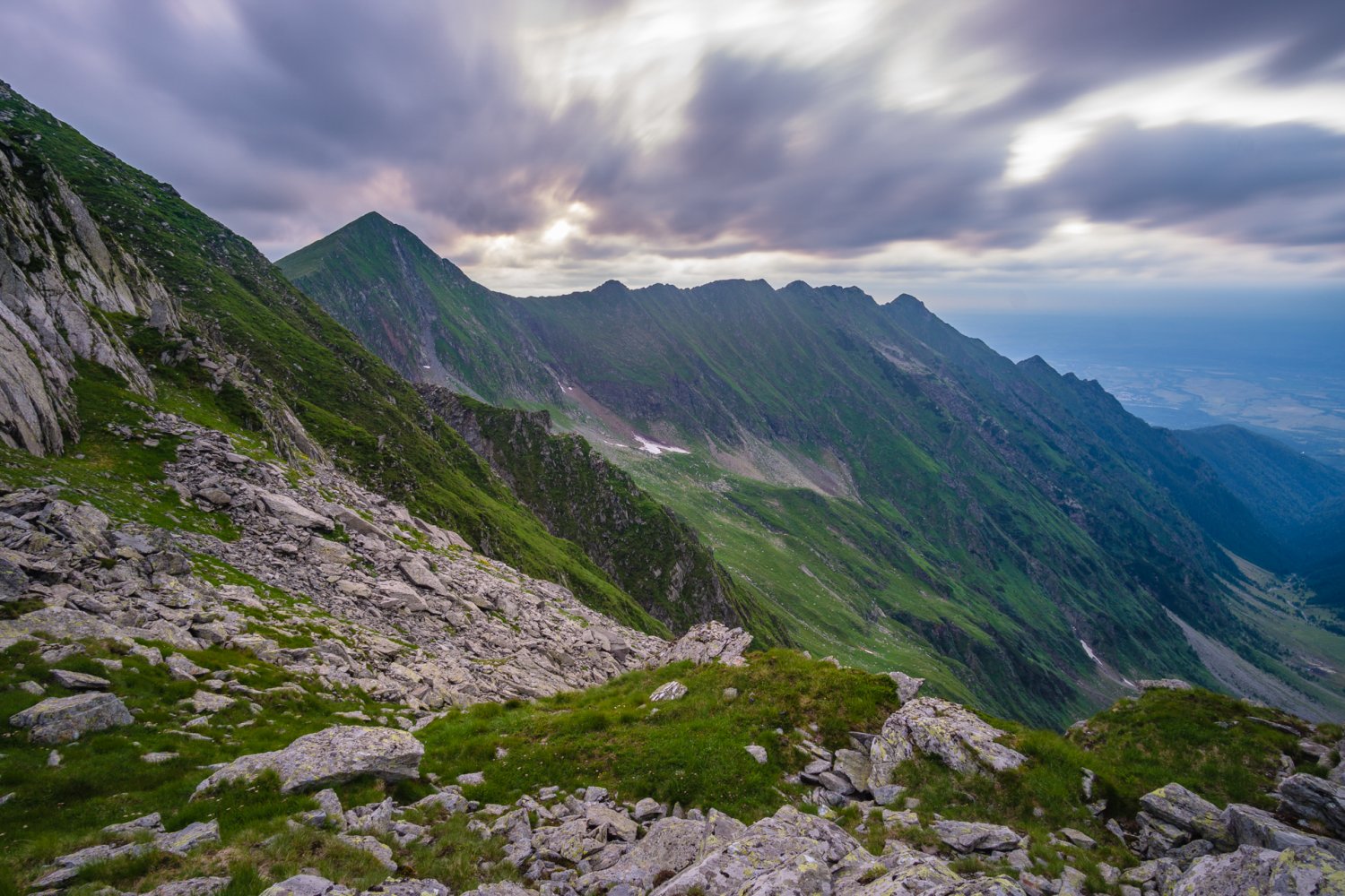
Dusk and fast moving cold front at Refugiul Viștea Mare
However, the most interesting part of Făgăraș to me were its rugged ridges. I actually used my midrange telephoto more than ultrawide lens as distant details simply seemed more interesting than grand panoramas with boring grassy foregrounds. Without including the trail into the photo I was often desperate to find something interesting to lead the eye into the image and enjoyed more distant ridges and mountains stacked one after another. With changing light and fast moving shadows interesting details appear everywhere and the only problem is that they disappear even faster.
Făgăraș is also more than rocks and grass when you look closer. Meadows are full of blooming herbs with blossoms ranging from pink and purple to yellow and white. These can enhance images taken there if you manage to get real close.
Overally Făgăraș is wonderful mountain experience but not for everyone. The fact that there are almost no huts and infrastructure and you have to carry everything with you through all the sections of the ridge trail combined with risky weather mean that these mountains are a real test of your hiking skills.