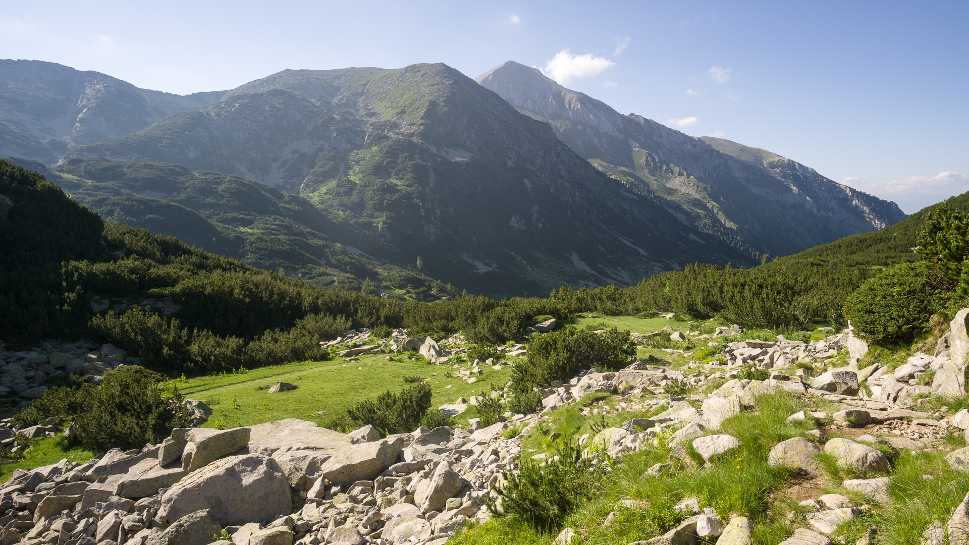
To get to the main ridge of Pirin, we choose the northern approach from Razlog through the Yavorov hut. Looking at the map, this is an obvious and straightforward ascend. The closer we get to the mountains, the more often we hear thunder from behind the ridge. Perhaps we are symbolically welcomed by the Slavic god of thunder, Perun, who gave his name to the whole mountain range and is said to be based on Vichren, its highest point.
As soon as we reach the Yavorov hut, a two-hour downpour starts. We are thinking what to do next. The hut owner talks about dangers of tomorrow's ascent to Vichren, perhaps at least the cozy Koncheto shelter could be reached. For the end of the first day, we choose an overnight stay in the shelter called Bunkera about an hour's walk from the cottage. We find that the shelter is occupied by a giant flock of flies and we sleep directly under the tin roof, while lightning strikes again into the surrounding gables. Probably not a safest thing to do.

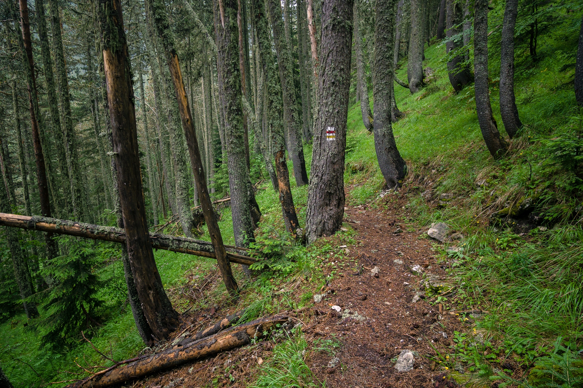
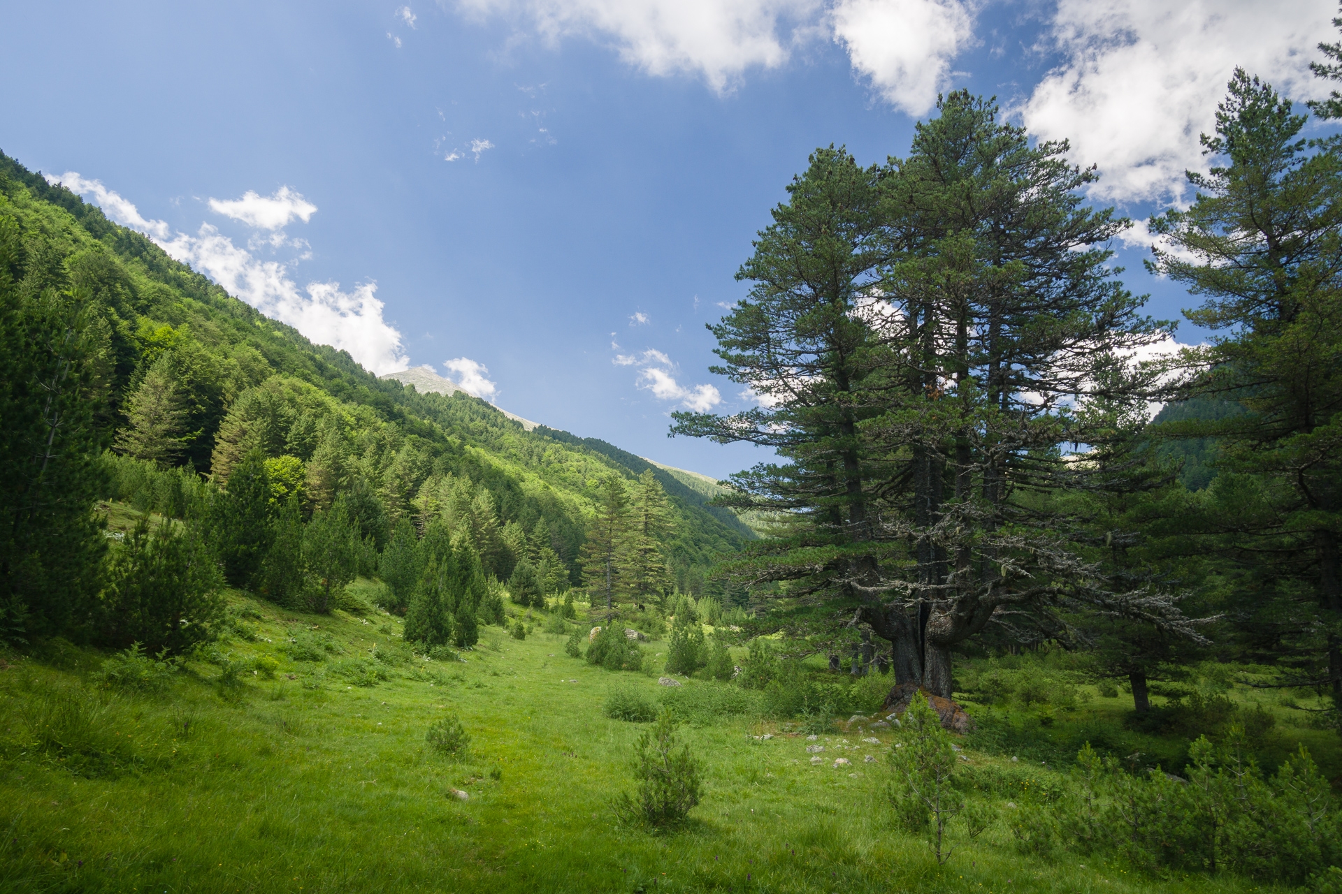
Woods above Yavorov hut

An emergency bivouac site under the Suchodolski Preval saddle
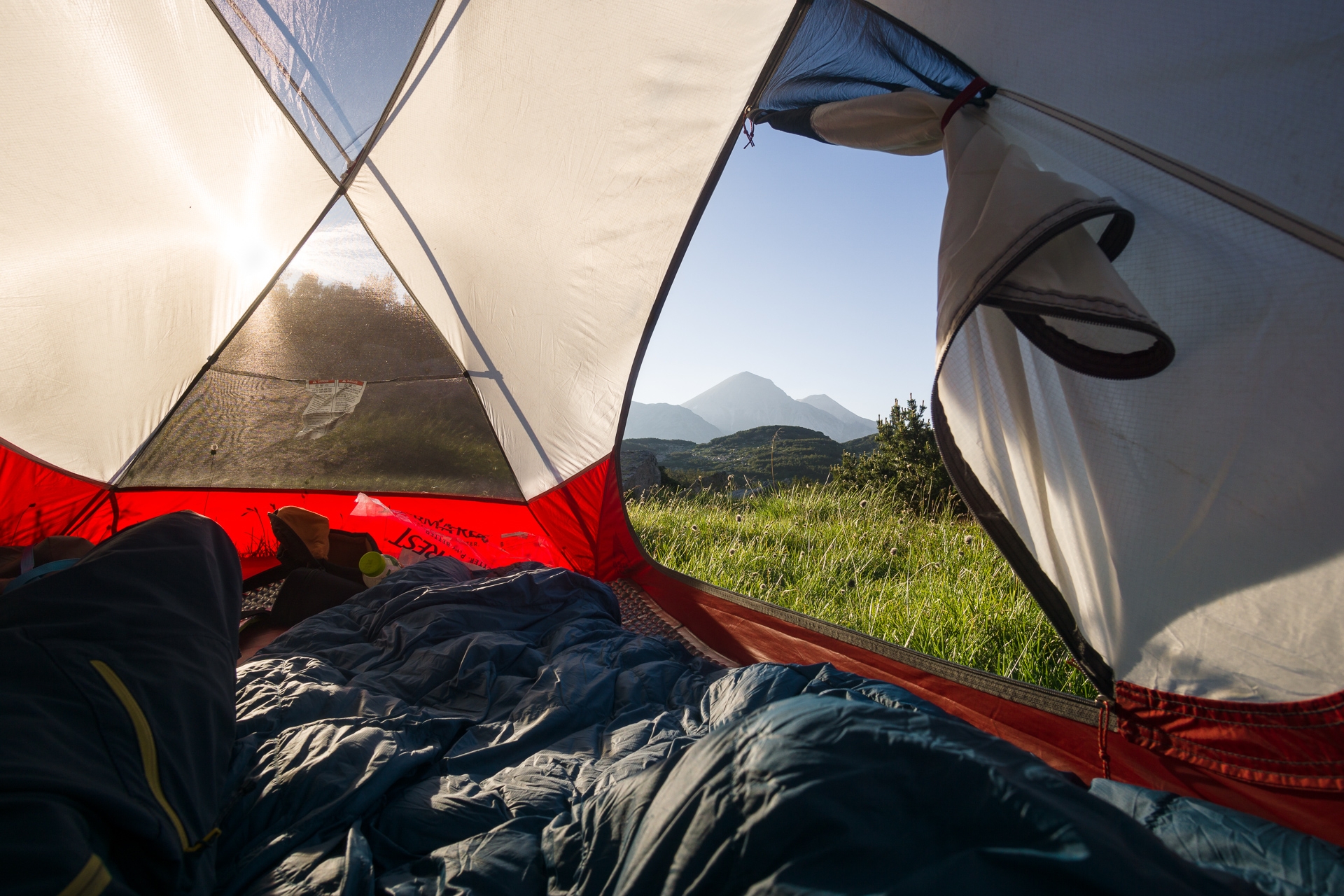
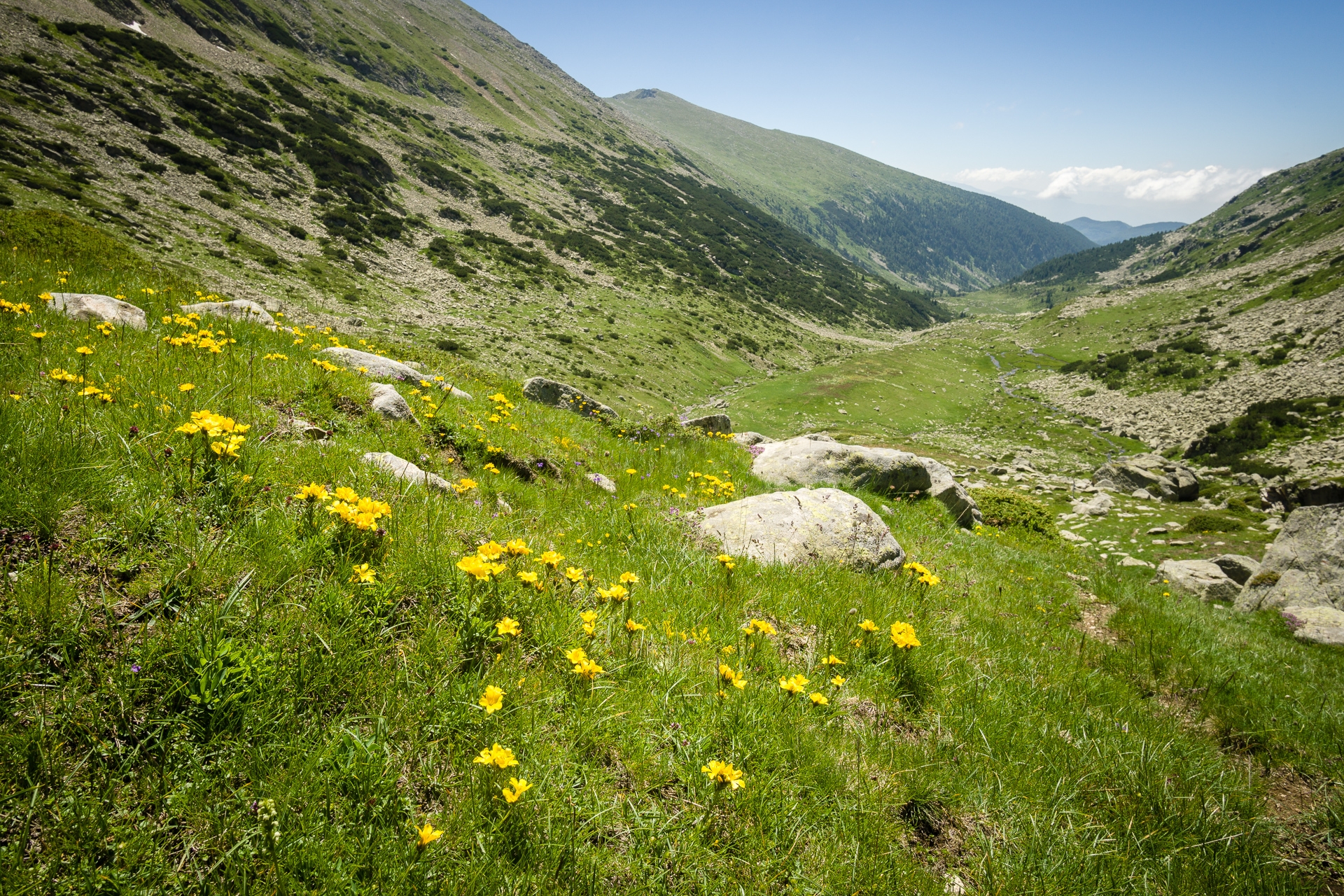
The ascent continues in the morning through the Suchodolsko valley, which is by far the least dry valley around. At Lake Suchodolsko, however, we refill our bottles with water, as there is no direct source of water for next day on marble ridge. A few hundred meters below the Suchodolsky preval, where the path turns left onto a ridge, a hailstorm starts again. We choose an emergency bivouac under the tent canvas between the stones. Many times lightning strikes into the nearby peak of Albutin, several times also into metal bars not far from us. When the storm passes after an hour and a half, the whole landscape is covered with hails like with fresh snow.
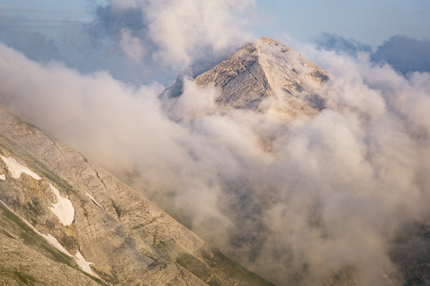
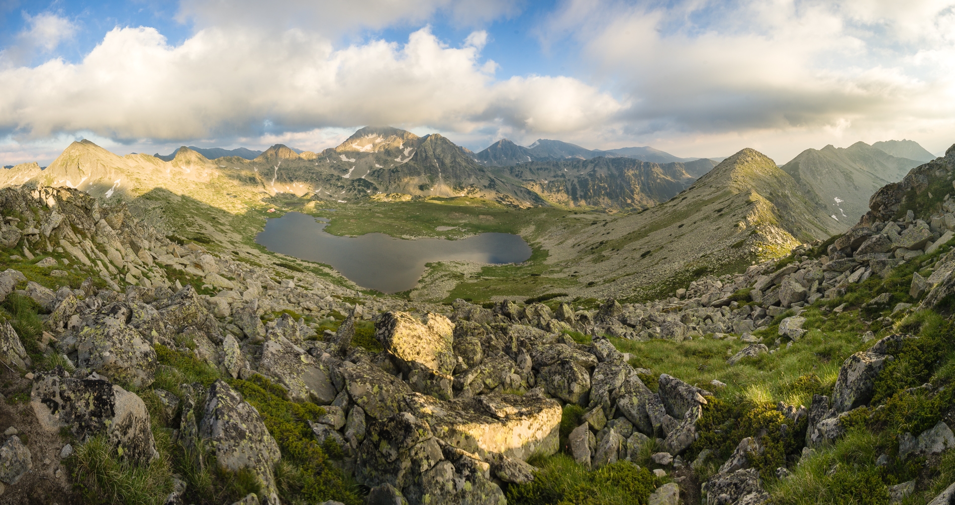
From the saddle Suchodolski Preval we can see the mighty Vihren for the first time. The giant marble pyramid rises alone away from the rest of the ridge and seems quite far away. Further than it might seem at first glance on the map, lies Koncheto shelter. We are in a hurry, storms are forming again in the distance.
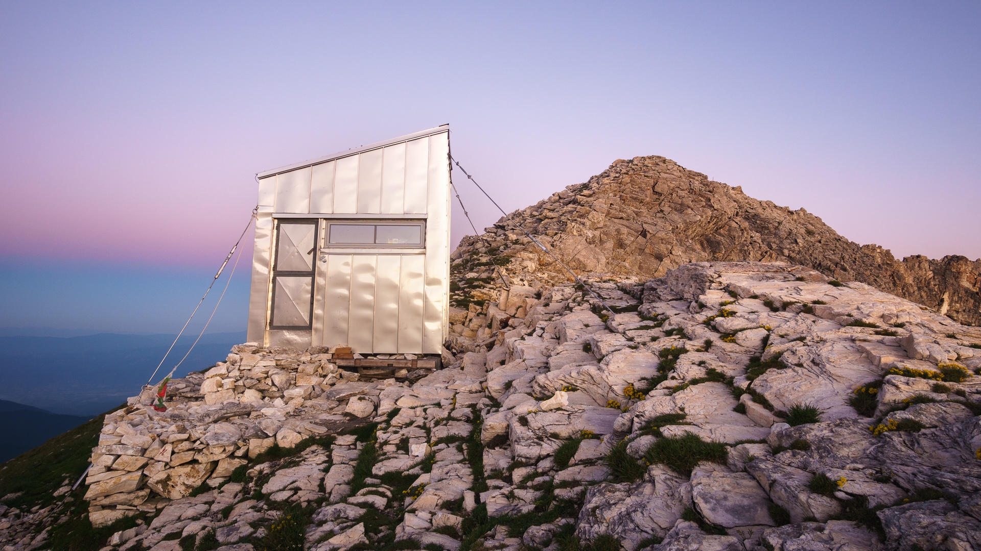
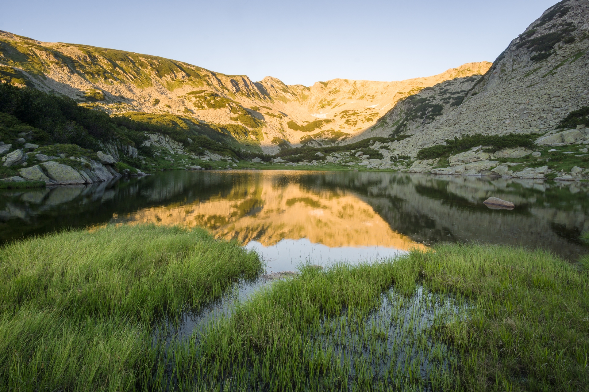
Dream conditions on Koncheto
When we come to a cozy place at an altitude of 2760 meters above sea level, I have no hope that it would be possible to take decent pictures today. The whole ridge is shrouded in fog, and we can still hear a roar of thunder bouncing off the mountain walls. We are exploring the shelter which replaced the older version here in 2018. It is ingeniously built, it does not seem that 10 people could stay overnight inside. Perfect use of space, the Bulgarians should take praise for this.

Vihren above clouds

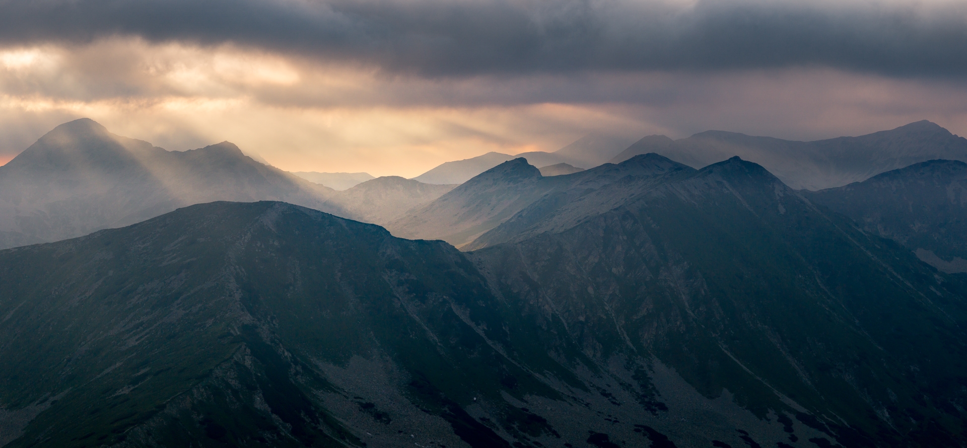
A strip of fog slides over Bayuvi Dupki
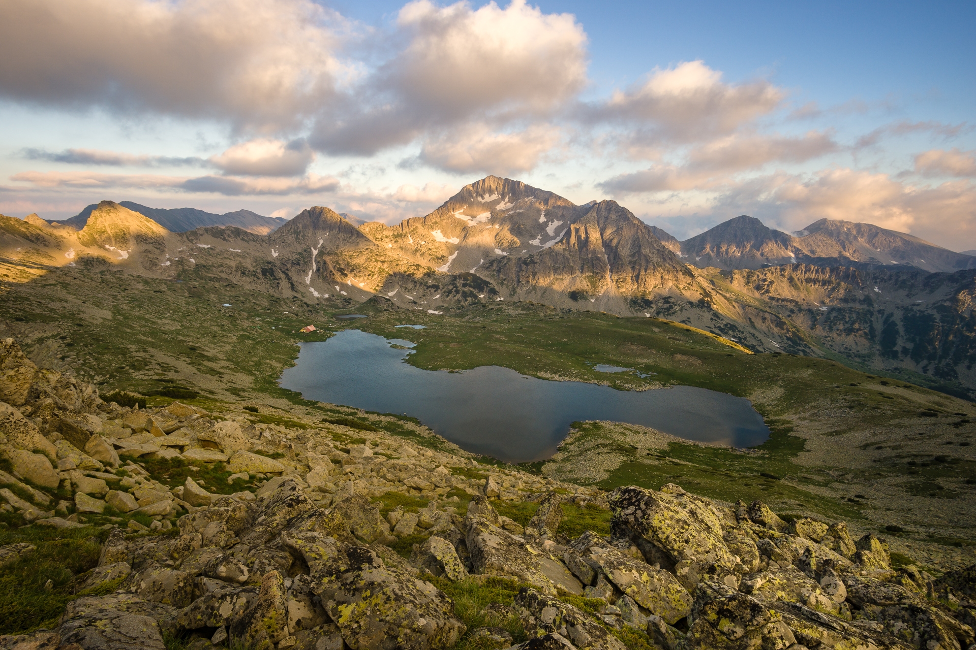
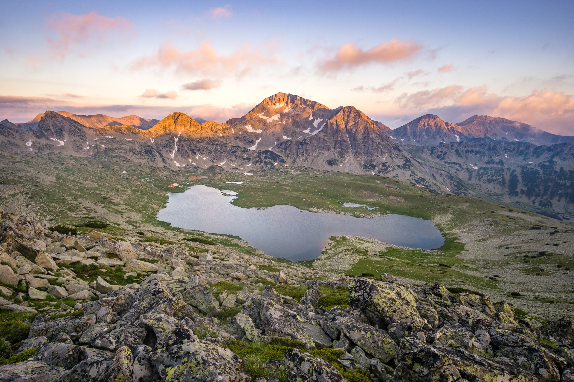
As the herd of chamois approaches in the evening, the clouds begin to break. The storm is gone, the feast is coming! At first, the clouds dissolve over the nearest peak of Banski Suchodol and remain only in the Vihren area. Lines of steam roll over the ridge for a long time before the highest peak is finally also revealed. The light is good, I just struggle with foregrounds a little bit, as everything around is formed by a monotonous rock. In the end, I find the best place just above the shelter towards the top of Bayuvi Dupki. When the best light comes, the ridge is shrouded in fog again. It would be a shame if the best didn't happen directly on the other side. The cloud rolls over the edge of the ridge and a sun disk shines through it. Everything is bathing in an orange glow.
Zaslon Koncheto

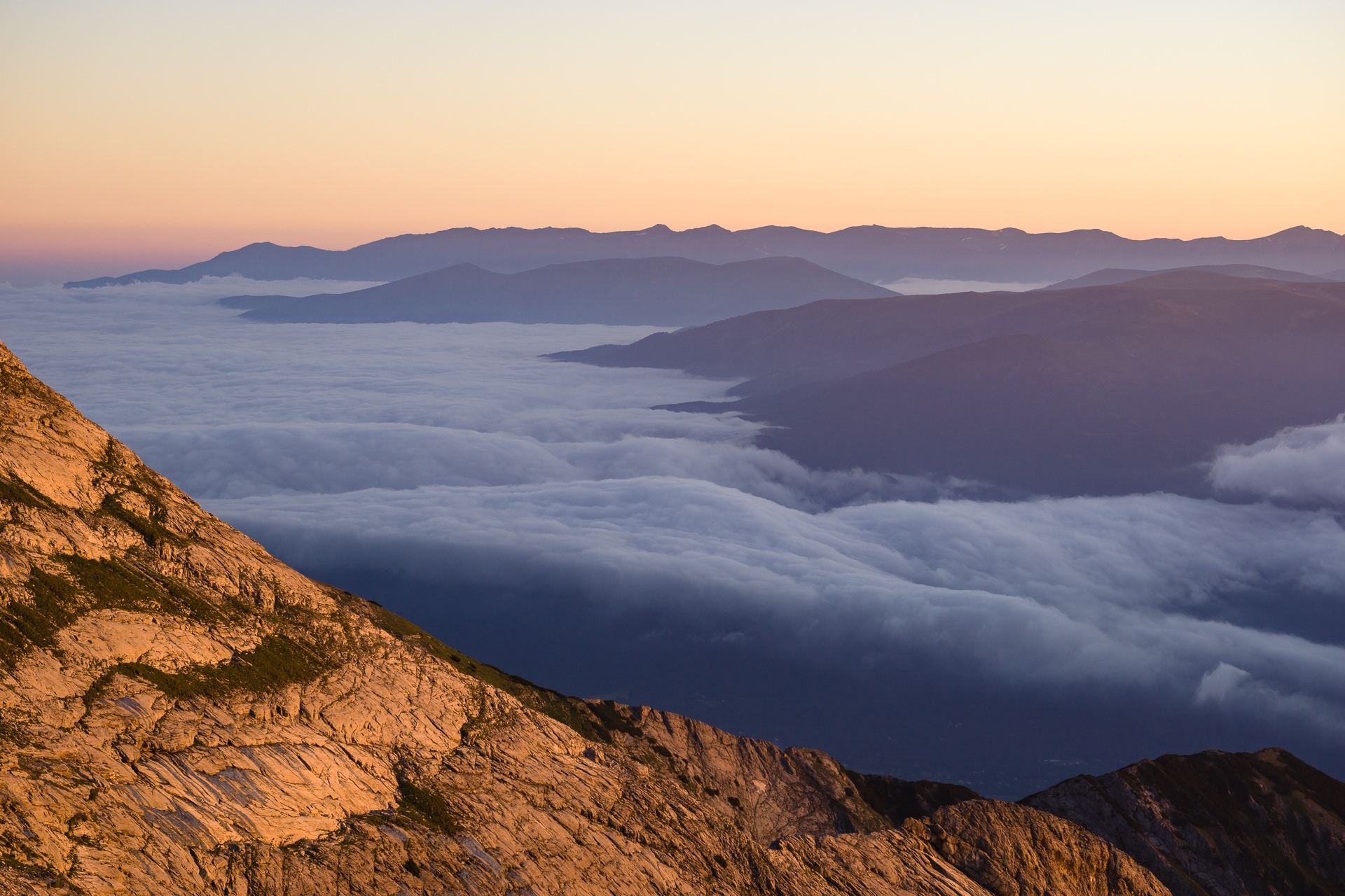
Peaks of Rila mountains rising above cloudy oceans


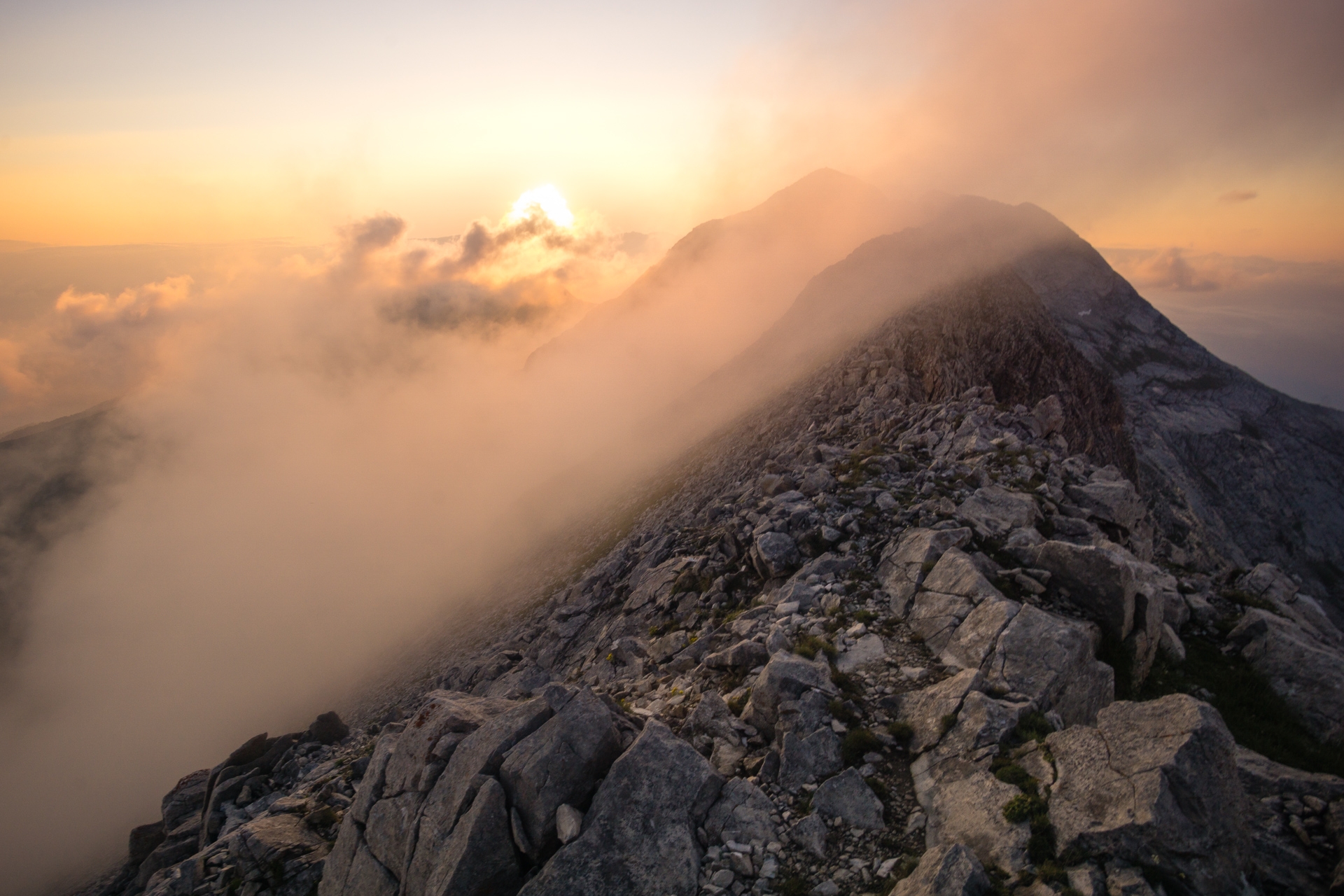
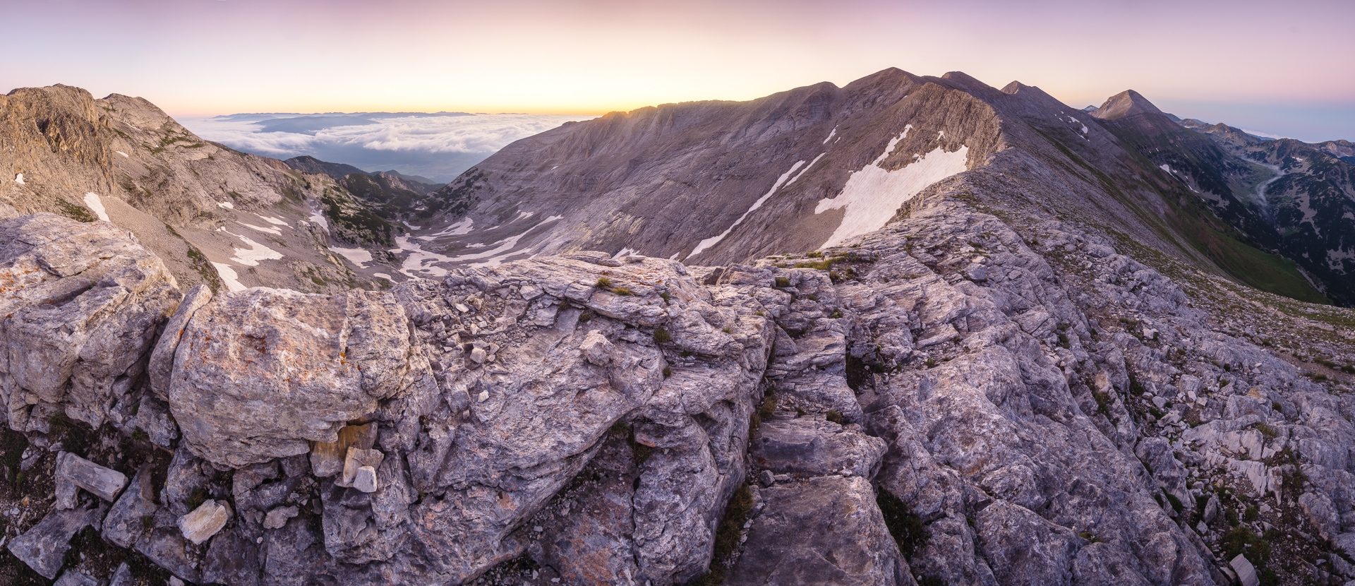
Marble ridge before sunrise
I get up at sunrise, conditions outside have changed a lot overnight. The clouds drowned somewhere down in the valley, a perfect inversion. An icy wind blows, but there are clear skies here in the mountains. I take pictures of the sun rising from behind the ridge, but what I like the most is the view of the neighboring Rila mountains, which are separated from Pirin by the aforementioned low clouds.
To the summit of Vihren!
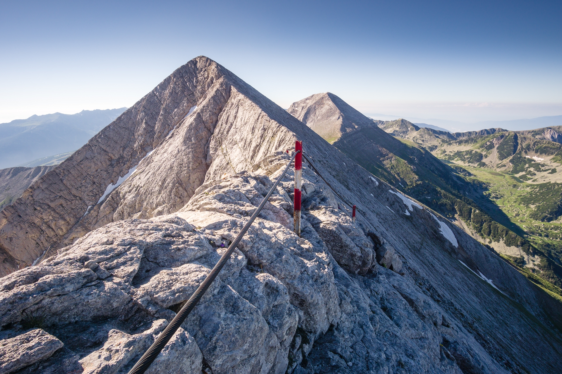
From the Koncheto shelter, the path continues directly over a rocky ridge. About halfway between Vihren and the cozy Koncheto there is a narrow edge, after which the shelter got its name. Perhaps it was necessary to cross this section "on horseback" (Koncheto means "a little horse" in bulgarian) before the path was secured with a steel rope. Even with the rope it is an interesting experience. On one side there is a gap of 400 meters, on the other almost 800. Directly in front of you rises the sharp peak of Kutelo, the second highest in the whole Pirin, and behind it on the right Vihren. We descend to the Premkata saddle and see the northern ascent route to the highest peak. We find that it is practically entirely secured with metal chain. From here it takes only about 40 minutes to the summit.

Below summit of Banski Suchodol

Koncheto edge
From the top, a view of the central part of the mountains finally opens up. Unlike the Vihren and rest of marble ridge, it is made of granite and could be roughly compared to the High Tatras in Slovakia. Somewhere down below us, the Vihren hut crouches. It seems close, but it takes almost vertical kilometer of descend to get there.
From here, the road to the middle of the mountains gradually rises again along the stream. All around, ferns grow and a huge number of mountain herbs bloom. The difference compared to the arid stony marble ridge is obvious at first glance.
The majestic pyramid of Vihren above the Banderica valley


Evening views

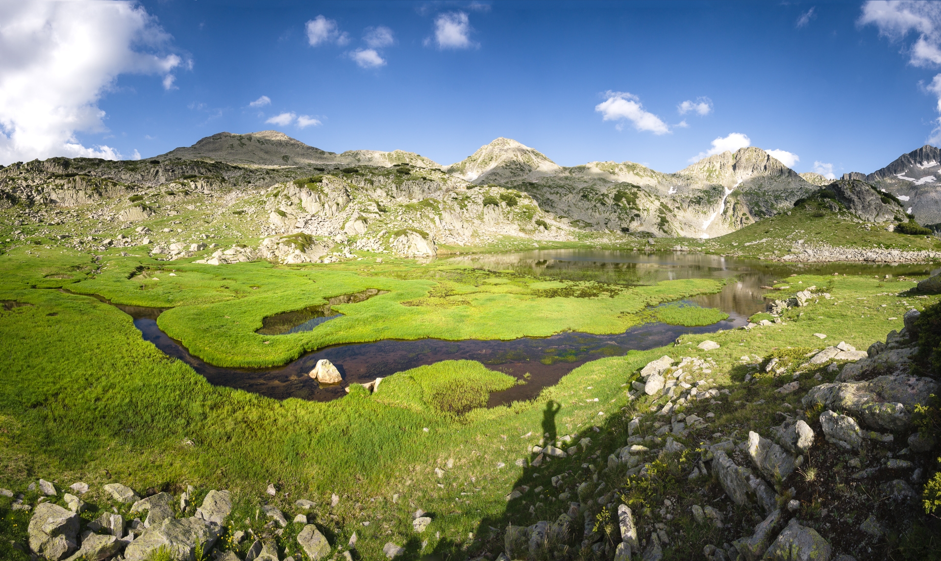
Lake basin Banderishki Circus
We do not have enough time to reach lake Tevno, so we bivouac just behind lake Dalgoto. The pyramid of Vichren still rises in the northwest, perhaps even more impressively from this side. I take photos late into the night around the lake and try to capture the sunset over the silhouette of the Muratov, Vihren and Kutelo peaks.
A short tiring section to Tevno Ezero
The warm evening turns into an icy night, in the morning pieces of ice fall from the tent. However, the sun quickly picks up power and begins to roast intensely. Especially between the stone blocks above the lake, the heat is downright tiring. Fortunately, the large lake Tevno is not far. However, the path is strangely slow, constantly rolling over the peaks of Tipik while the Mozgovishka Porta saddle below the lake still seems far away.
The sky is a bit dull without clouds, only on the southern side of the mountains, deep in the valley, clouds start to form. Clouds like that won't help me, I tell myself, as the sun still shines on clear sky above.
We arrive to the lake in ideal time in the afternoon. What I would not have believed in a while ago is now becoming a reality. Small clouds begin to rise against the blue sky. So far, they are too small, but better than nothing.
Evening on Tevno Ezero
Overgrown smaller lake located 50 meters below hut at Tevno catches my eye as well as peaks surrounding this area. I wonder which location to prefer for evening shooting. It seems that the lake below will soon hide in the shade, so I go there immediately. This way it should be also possible to ascent to one of higher peaks on time before sun sets. Access to the lakes is easy along a marked route. On the spot I find the best composition a little to the side on one elevated rock above the curved meanders. I like the shape of the meanders copying the shape of the mountains in the background and the golden afternoon sun illuminating the surrounding grassland.

Meanders under Tevno Lake. In the background Momini Dvori, Kralev Dvor and Malka Kamenitsa.
Soon, however, the sun moves too low and beyond the edge of a nearby ridge so the meanders remain in shade. I return to the hut and wonder which of the nearby peaks to choose to climb. There is the lowest Valyavishka Chuka, the middle one called Valyavishki Chukar or the highest and the most difficult peak Momini Dvory. I choose the middle peak, especially because of its position in relation to the lake and the dominant peak opposing it - Kamenitsa.
As soon as I climb along the lake, things start to happen. Suddenly, I am surprisingly afraid that there will be too many clouds, that the sun will hide behind them and good light will not take place. At that time, I still have no idea that there will be just enough clouds all evening, the sun will not disappear even once and the surrounding peaks will appear in perfect colors.
Golden light from the top of Valyavishki Chukar.


Orange light and perfect clouds.

The last red rays on the peak Kamenitsa.
Everything takes place naturally, as it did many times before when the conditions were damn good. I reach the top and look for the optimal composition. The view of the lake must stay clear and it would be nice to have something interesting in the foreground. The absolute summit doesn't work because of the foreground, the slope is too steep. So I move to a comfortable spot just below. Within an hour, the light turns golden and orange, until it turns red at the very end of the day. The opposite peak of Kamenitsa is illuminated all the time. It could not get any better.

The ridge route leading over the nearby Prevalski Chukar to Tipik and Opreno. On the left Banderishki Chukar, behind it Muratov in clouds. On the right in the background Todorka and behind it Vihren in clouds.
Through scented landscape to Rozhen
From the lake Tevno, we first ascend to the saddle Kralevdvorska Porta, so that the path then practically just descends to the south. If anything speaks for this variant of leaving Pirin, it is the diversity and speed of changes in the surrounding landscape. The descent begins high in the mountains where snow fields remain even in July. It continues through extensive meadows in calm elongated valley. Perhaps because this valley is situated to the south, an incredible number of plants of all colours bloom here.

Blooming southern slopes.

In the shade of old pine trees.
When the trail reaches the forest border, the macedonian pine is dominating tree type. Under old branches it is finally possible to find some shade. Not far from the Pirin hut, the forest once again changes into a mixed fir-beech. From here it is still over 1,300 meters downhill to the first settlement of Rozhen. The forest soon becomes airy, with oaks everywhere and thorns growing in the sunny open spaces.
The heat strikes Before Rozhen with the greatest force. Long ago the moist dark forests are gone, only sparse oaks, junipers and yews remain. The grass in the area is burnt brown in early July. Cicadas are heard everywhere. Rozhen is close, and with it the kingdom of arid sandstone pyramids, where the landscape resembles a semi-desert. Towards the end, we are so tired of the heat that we literally go from shadow to shadow.
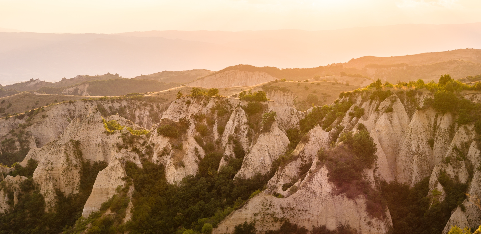
In the world of pyramids
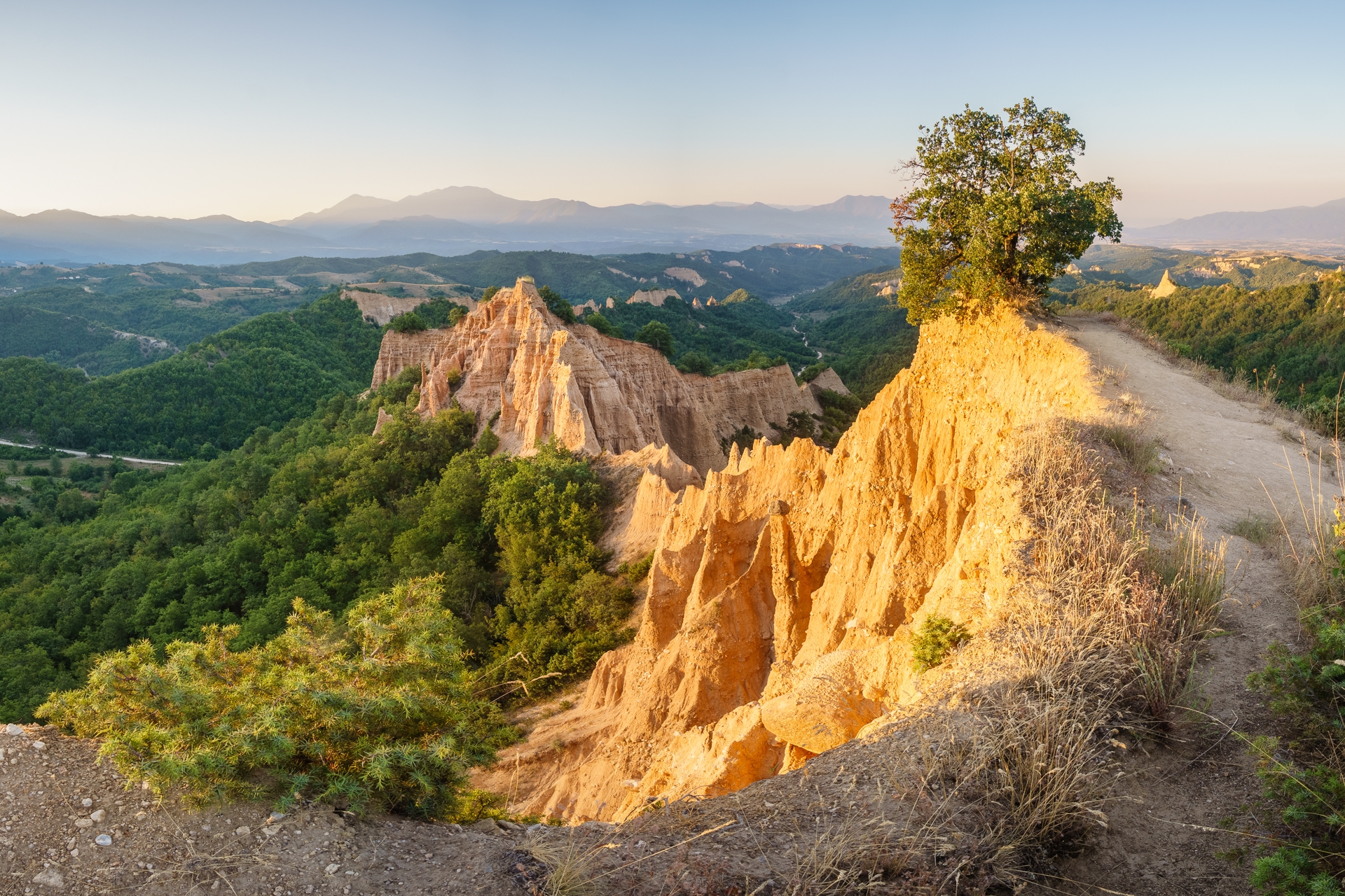
The end of the road to the settlement of Rozhen is lined with smaller sandstone formations. During the ascent to the local monastery, the landscape opens up and makes the first impressive wide views stand out. The Rozhen monastery then represents an oasis of peace and relaxation for the soul after a day spent in the heat of the relentless sun. But the best of the rock area comes just behind it. The road climbs sharply again, but soon reaches the first vantage point.

The central part of the Melnik pyramids
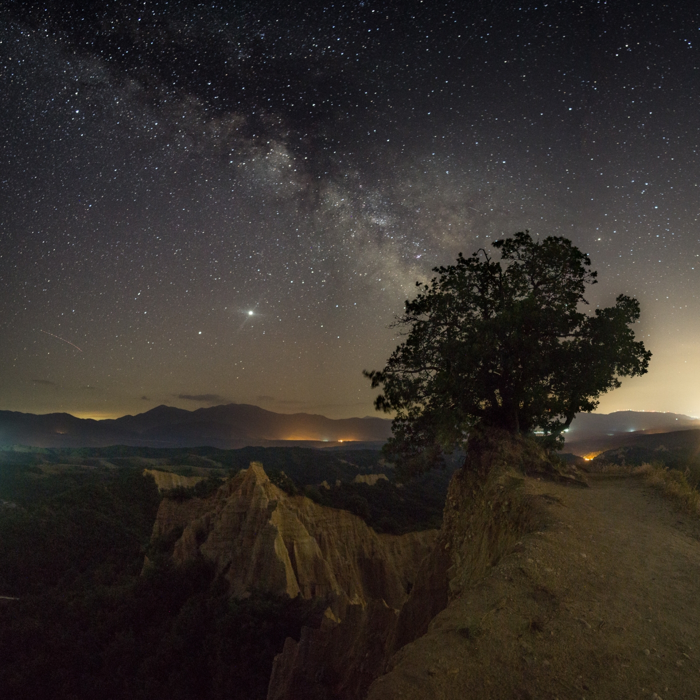
It might seem that it can not get any better. On one side a view of the monastery, on the other side a view directly towards the wildest shaped rock in the area. However, the sharp eye notices the path leading further towards this rock. There you can find probably the best place in the whole labyrinth of pyramids. It offers a view of the central part of the area and especially of the nearby almost vertical rock formed by prehistoric sediments. The place is completely arid, but perfect in terms of composition. At the very end of the accessible rock, a twisted oak tree grows and the rocks are positioned so that one wall is illuminated by the sun in the evening and the other early in the morning.

Pyramids at night under the Milky Way.

At dawn on the lookout
From the vantage point, the road descends sharply towards Melnik. Although it is close to the largest rocks, it is a bit dull. It descends into the forest and some of the pyramids just peek out here and there between the branches. Nevertheless, even here it is clear how drastically the landscape can change in a few kilometers. If something makes Pirin mountains unique, it is the diversity. On a relatively small area, you can find a rugged marble ridge, granite part of the mountains, large meadows with pine trees and further down oak forests. On the southern edge of the mountains towards Greece, the landscape changes into an almost Mediterranean form.